
![]()
Traffic Advisory
Upgrade of the R336 between Addo and Nqweba Phase 2, Eastern Cape
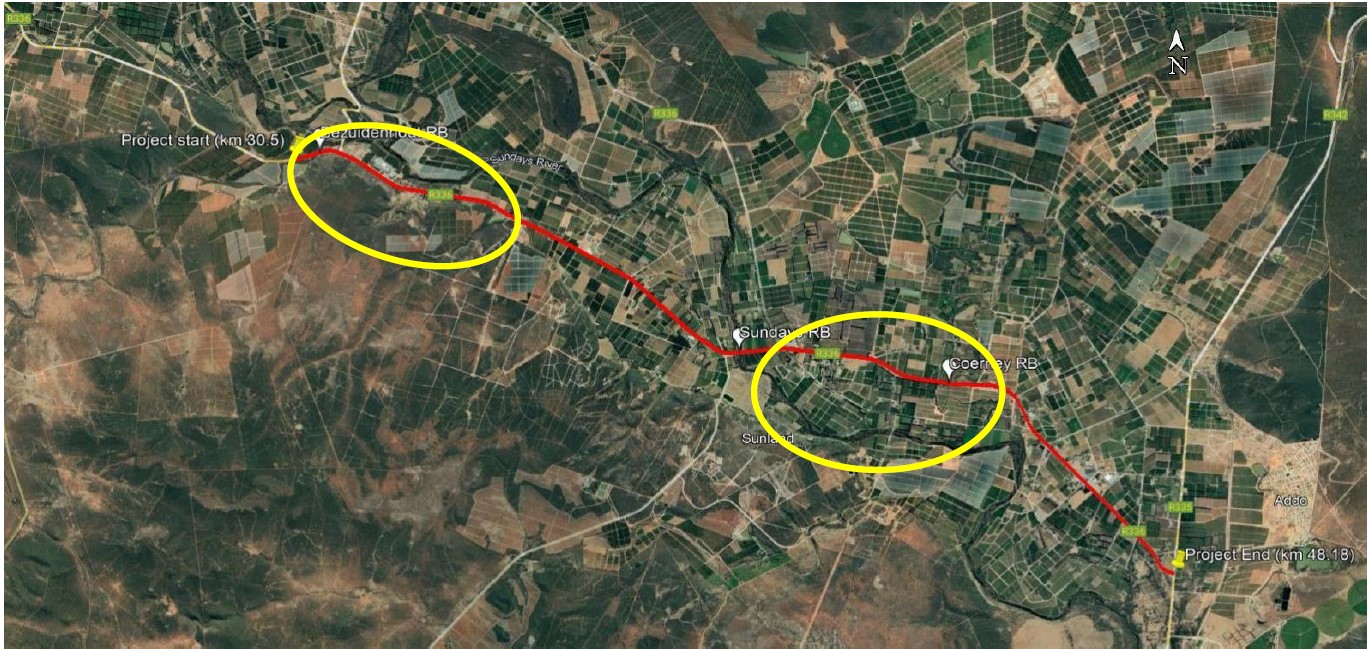
Caption: The upgrade is taking place between Bezuidenhout River and Addo. (The route is marked red on the map.) Closures marked in yellow
Gqeberha, 7 July 2025—The South African National Roads Agency SOC Limited (SANRAL) wishes to inform road users about the ongoing road upgrade project on the R336 national road, which extends from Bezuidenhout River (approximately 13 km from Nqweba Town (formerly Kirkwood) to the intersection of the R336 and R335 national roads near Addo. The project is scheduled to continue until November 2025.
“This upgrade encompasses 17.7 km of the R336, specifically between the 30.5km and 48.2km road markers. As part of Phase 2, the road will undergo significant improvements, including widening lanes and shoulders, enhanced intersections, widening of two bridges, construction of one new bridge and the addition of pedestrian facilities where necessary. These upgrades are intended to improve overall mobility and create a safer driving environment.”
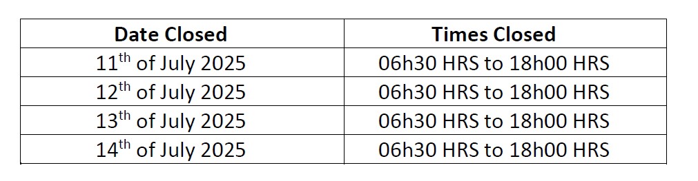
“A section of the R336 road, from KM 42.9 to KM 43 over the Sundays River Bridge, will be closed to traffic from 11 July 2025 to 14 July 2025 from 06h30 to 18h00. This closure is necessary to allow the contractor to safely install concrete precast beams on the bridge extensions. To ensure public safety, the road will need to be fully closed while this work is underway,” said Kayakazi Mafuta, SANRAL Eastern Cape’s Acting Provincial Head.
The following dates and times represent the road closure schedule:
During the closure period, a clearly marked detour route, stretching 14.5km, will be in place. The route will begin at the Dunbrody turnoff, pass through the farm areas, and rejoin the R336 road via Tregaron Road near the FRESHCO packhouse.
Motorists travelling from Gqeberha (formerly Port Elizabeth) heading to Nqweba (formerly Kirkwood) from 11 July 2025 to 14 July 2025 are advised to use the R75 and turn onto the R336 to Nqweba.
Some Valuable Information
“If motorists find themselves in an emergency and need to provide their position, they should use the route markers along the side of the road. These route markers are placed every 200m and provide sufficient information on the exact location and route”.

“Motorists are urged to plan their journeys in advance for the weekend, use the designated detour route, and adhere to all traffic signage in place”, added Mafuta.
SANRAL apologizes for any inconvenience caused.
Ends//